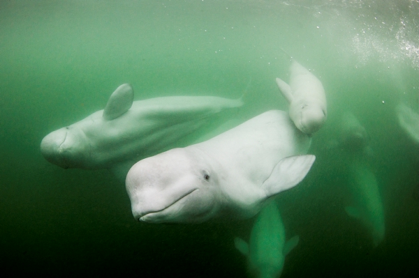
In 1973, the Endangered Species Act (ESA) was passed to help provide protection for endangered and threatened species and their habitats. And it worked! Because of the ESA, our kids will be able to hear a humpback whale call, swim amongst vibrant coral reefs and know that monk seals still swim off the coast of Hawaii. For more than 45 years, this law has been vital for saving and protecting some of our favorite ocean animals—and without the ESA, many of these species may have become extinct by now.
But now, the Trump administration has targeted the ESA as it continues its assault on environmental protections.
The administration has proposed a new rule that would severely undercut the ESA’s habitat protections. The new rule would add a definition of “habitat” that would leave areas important to imperiled species’ survival and recovery open to exploitation by big polluters, like oil and gas companies and mining companies.
Stay current
...loading
Thanks for signing up for Ocean Conservancy emails.
More specifically, the proposed rule would limit the type of habitat that could qualify as “critical habitat”—the habitat needed for a species to recover. The rule could also prevent the designation of habitat areas that were historically used by a species, areas that could provide additional habitat for recovery if they were restored or modified in some way and areas that may become suitable for recovery in the future as species move in response to climate change. In short, the proposed rule would make it much more difficult to protect habitats that listed species need to recover and flourish. And it would make it easier for polluting industries to destroy wildlife habitats and drive our most threatened species to the brink of extinction.
From safeguarding habitat to ensuring essential protections, here are some ocean species being helped by the ESA right now:
If the administration succeeds with this new rule, it would make it even harder to protect habitats necessary for imperiled species to recover. And we could lose species vital to healthy marine food chains and productive ecosystems. We can’t risk backtracking on these important protections.
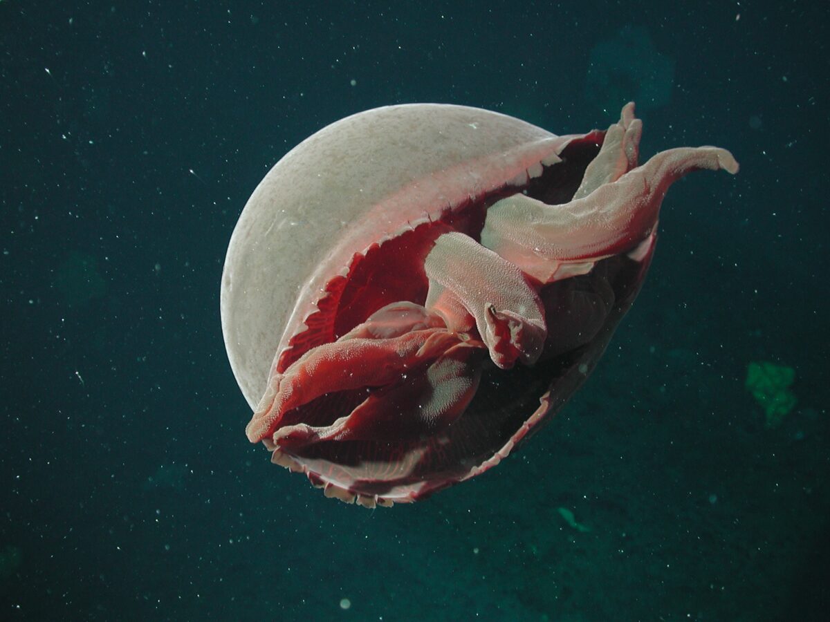
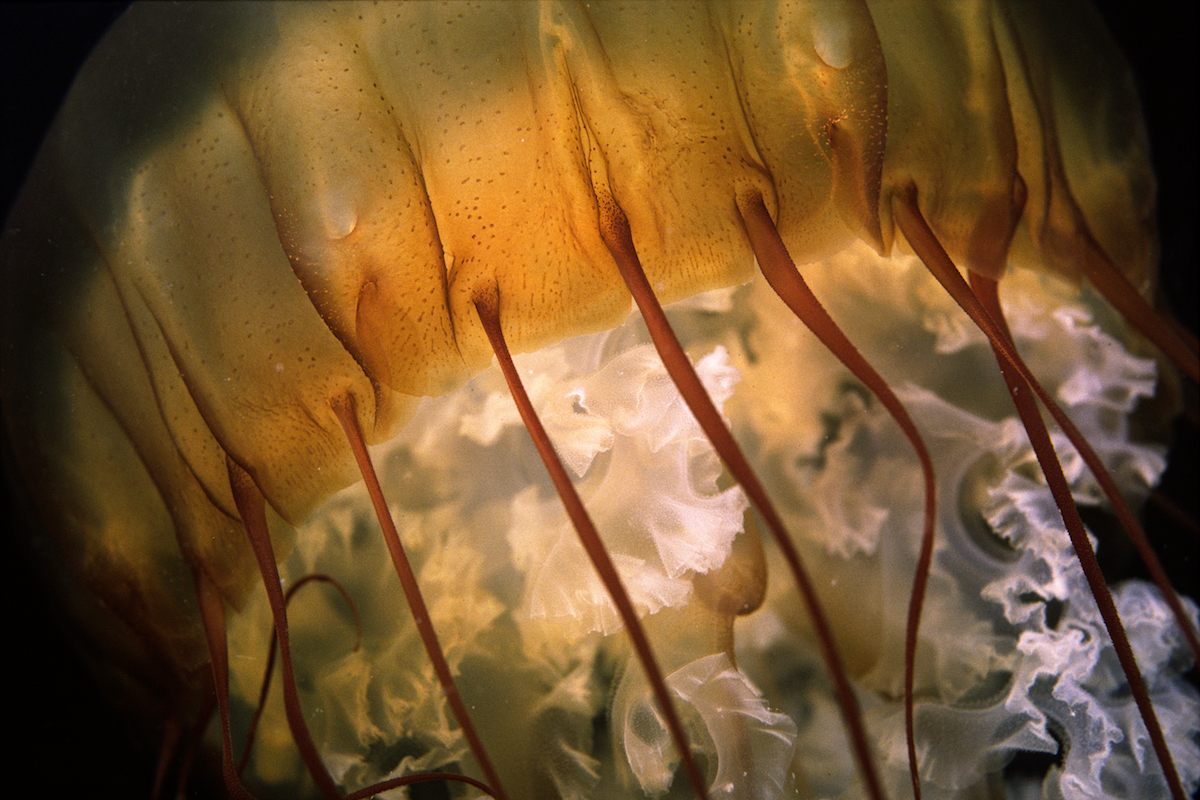
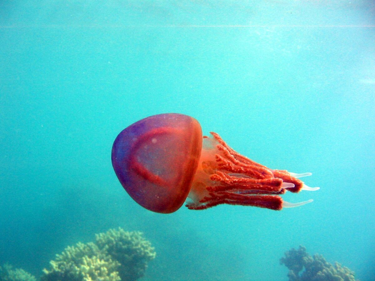
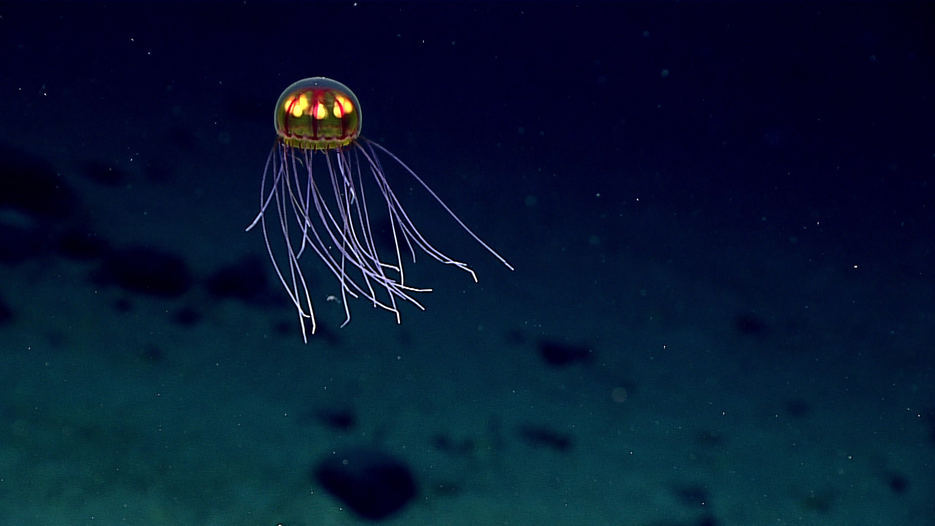
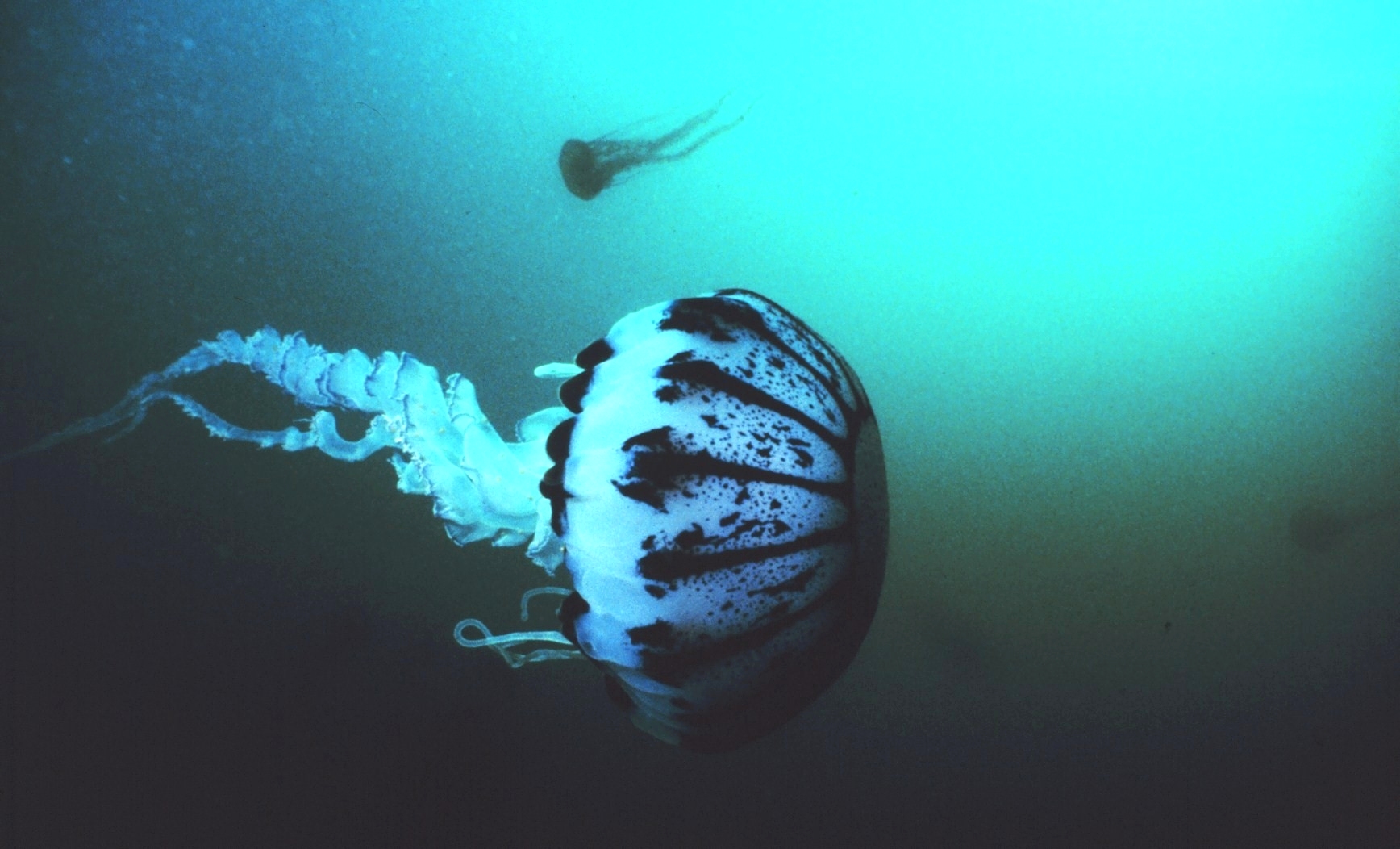
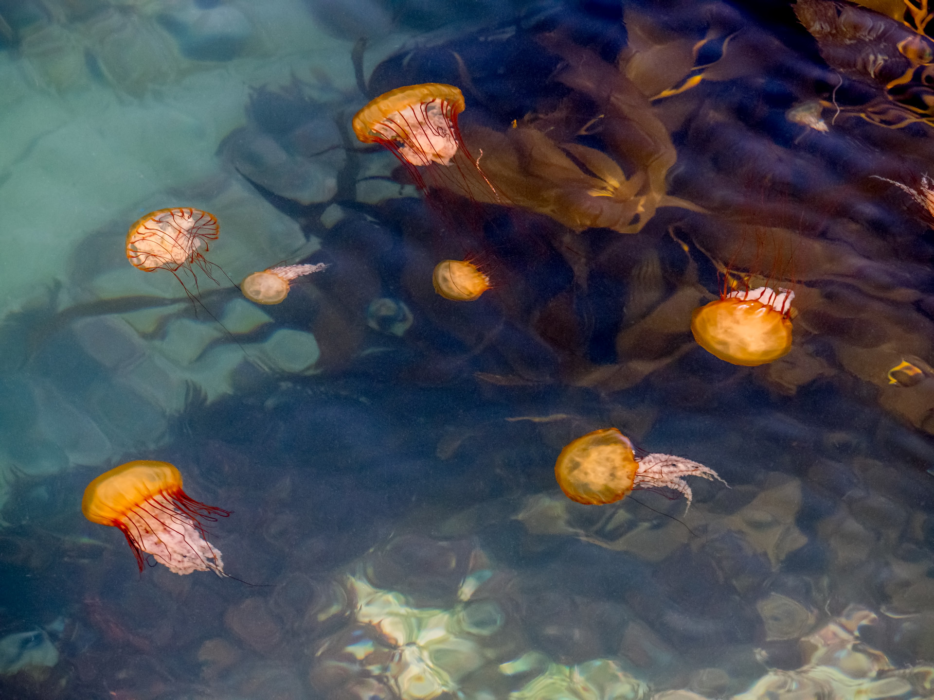
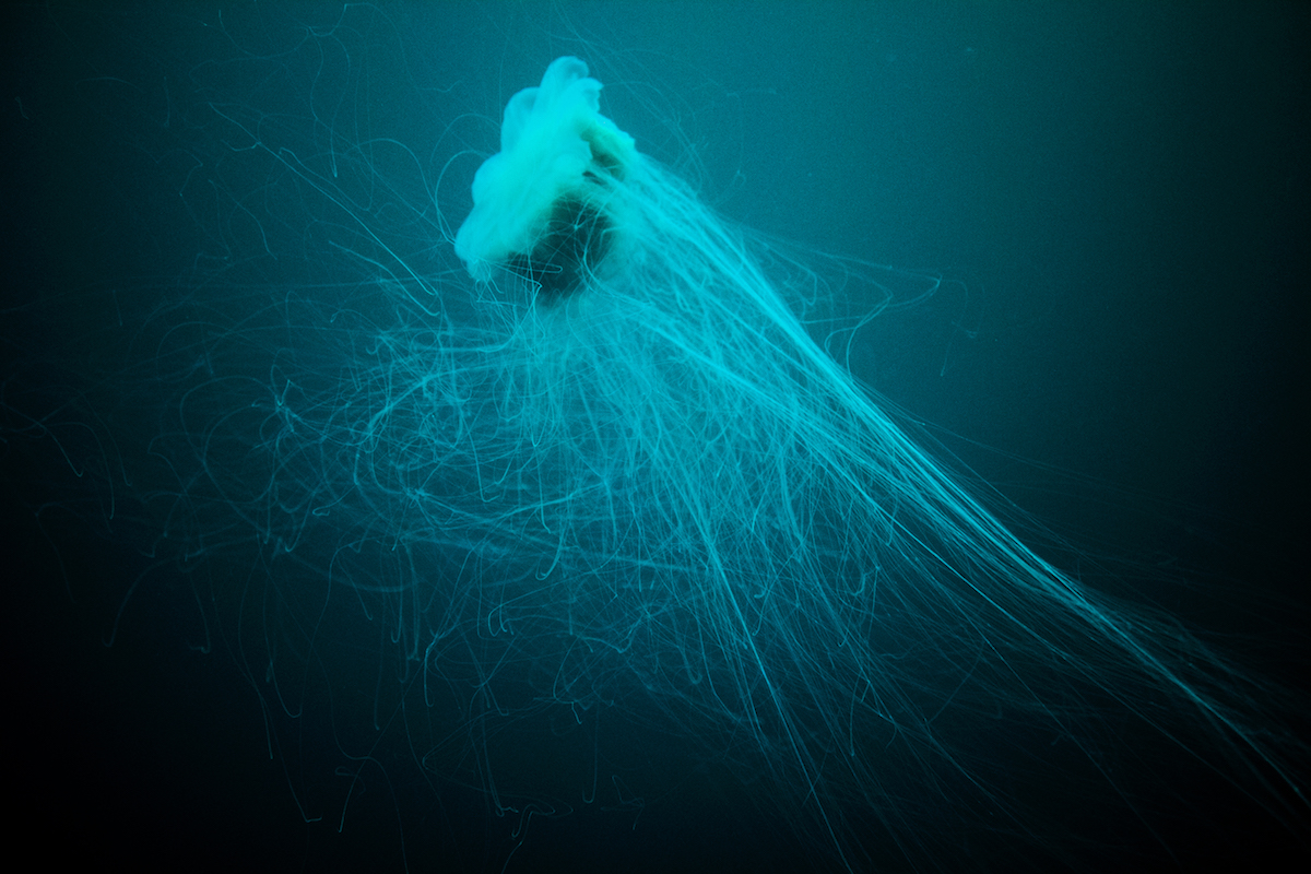
One of our main concerns at Ocean Conservancy is climate change and its impacts on our communities, resources and wildlife. Bleaching corals are among the first signs of climate change impacts we have seen have seen in our ocean. And though climate change has been a stressor on most ocean wildlife, there’s a particular group that has high adaptability and predicted success for the future, particularly in the face of climate change—sea jellies.
Sea jellies (or jellyfish) are a charismatic subphylum that is familiar to all. Fossil evidence dates sea jellies as far back as 500 million years ago—if not longer. They are soft-bodied creatures consisting of at least 95% water, possessing a simple structure and a noticeable lack of almost everything that distinguishes plant from animal—including blood, a heart and a brain.
Warming temperatures, increased salinity and increased acidity are causing the demise of many ocean creatures, but due to their lack of complex features, these are not a problem for sea jellies. In fact, warm temperatures and dead zones (areas of water with depleted oxygen) are places where sea jellies thrive; and because their natural predators, like sea turtles, fish and sharks, struggle in these changing environments, their numbers will only continue to grow. As the sea jelly population rises, here are a 10 photos of our favorite thriving jellies:
The events of the past few months have been a wakeup call for us at Ocean Conservancy. We know that to create lasting, structural change for our ocean and the people that depend on it, we must tackle systemic racism. The murders of George Floyd, Breonna Taylor, Ahmaud Arbery and countless others have sparked a nationwide reckoning and brought a renewed sense of urgency to this work. As I said in my blog for World Ocean Day,
“Does an ocean conservation organization have a role to play in dismantling racist systems? I know we do. Will the ocean be better off in a more just and equitable world? I know it will.”
It’s not enough to recognize the problem—we need to actively take a role in dismantling racist systems as we pursue our mission of ocean conservation.
Never miss an update.
Sign up today:
...loading
Thanks for signing up for Ocean Conservancy emails.
As a predominantly white organization that benefits from social and political structures that perpetuate structural racism, we know we have a long way to go. I’m extremely proud of the frank and difficult discussions we’d had at Ocean Conservancy about ways we can all contribute to the fight for racial equity. We are making sure these conversations lead to action, and I look forward to sharing more about the changes we’re implementing internally, as well as the work we’re doing (starting with listening and learning) to incorporate justice and equity into our conservation work.
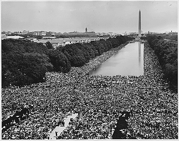
Ocean Conservancy’s internal conversations led us to become a sponsor of this year’s March on Washington. It’s taking place on August 28, 2020—exactly 57 years since the historic march where Mahalia Jackson serenaded the Washington Mall, the late Honorable John Lewis called for Americans to wake up and where Dr. Martin Luther King, Jr. delivered his famous “I Have a Dream” speech. The original march brought together 250,000 people from all over the country to protest employment discrimination and civil rights violations.
It’s sobering to think that almost 60 years have passed since that march, and there is still so much work to be done. We are honored to support the organizers of this event.
Although the March on Washington is a powerful time for reflection, Ocean Conservancy’s support for Black lives needs to extend beyond big events. In addition to the work we’re doing internally as an organization, we are committed to amplifying Black voices and communities in the field of ocean conservation.
I want to recognize some of the Black individuals and communities who are taking action for the ocean and beyond. I hope you will join me in learning more about their work and supporting their initiatives.
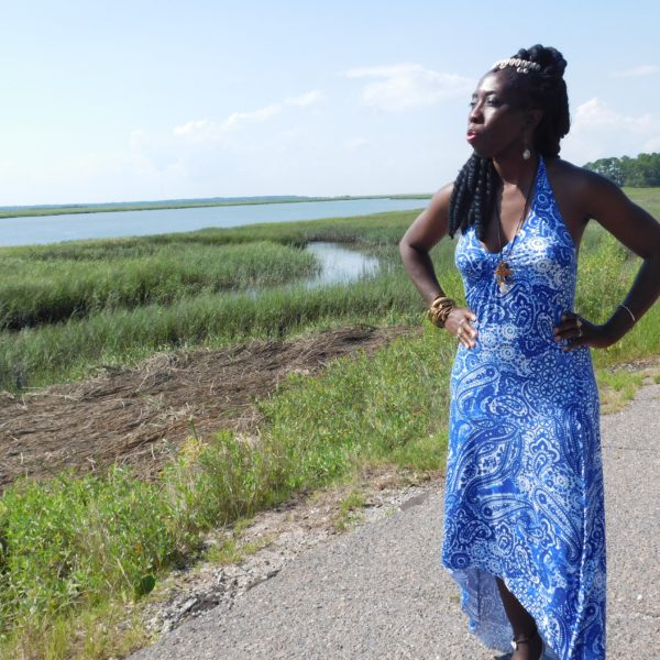
The Gullah/Geechee Nation, led by Queen Quet, is fighting to protect their coastal community from the impacts of climate change. Stretching along the Southeast coast from North Carolina to Florida, the community is comprised of descendants of enslaved Africans who rely on coastal fisheries for their physical and economic health. Queen Quet has spoken from the floors of Congress to the halls of the UN, sharing stories of how climate change is affecting the Gullah/Geechee way of life. Read more from Queen Quet here.
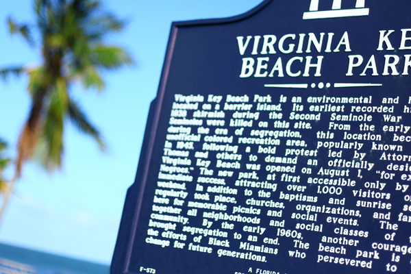
This month was a big milestone for the team at the Historic Virginia Key Beach Park in Miami, Florida: They celebrated the first-ever Historic Virginia Key Beach Park Day on August 1, 2020. That day marked the 75th anniversary of the park, which was a getaway for Black Floridians when other beaches were closed to them because of segregation and Jim Crow laws. We have been privileged to partner with the wonderful team at the Historic Virginia Key Beach Park for multiple beach cleanups.
I invite you to join us at the March on Washington this week, whether virtually or in person, and come with us on our journey as we learn and take action to support Black lives. And most importantly, I want to repeat something I said on World Ocean Day this year—I urge you to hold us accountable to our commitment to being a true ally to the Black community, as well as Indigenous people, People of Color and other marginalized communities as we incorporate justice and equity into our work.
New study contradicts assumptions of constant element conditions in the oceansThe compositional ratios of elements such as magnesium, calcium or strontium in seawater are an important means for the reconstruction of past oceanic processes. So far it has been assumed that these ratios are constant over long periods of time and over large areas. However, a study led by Kiel University (CAU) and the GEOMAR Helmholtz Centre for Ocean Research Kiel shows that important element ratios in today's oceans are much more variable than previously thought. This finding also raises questions about the reconstruction of ocean history. The study has been published yesterday in the international journal Proceedings of the National Academy of Sciences (PNAS).
from "Future Ocean" – News https://ift.tt/3aWAdTu https://ift.tt/eA8V8J
DFG funds an Emmy Noether junior research group led by Kiel marine researcher Meike StumppThe German Research Foundation (DFG) recently approved the establishment of a new Emmy Noether junior research group at Kiel University (CAU). The marine scientist and future head of the new research group, Dr. Meike Stumpp from the Institute of Zoology at CAU, and her team will investigate the metabolic processes of larvae of marine invertebrate organisms, with particular focus on sea urchin larvae. The research, which is funded by the DFG with around one million euros and two doctoral positions, focuses on improving our understanding of digestive physiology.
from "Future Ocean" – News https://ift.tt/3jad6aX https://ift.tt/eA8V8J
This blog was written by Sophie McCoy, a marine scientist who studies ecological responses to pollution and climate. Sophie is a Lang Early Career Fellow of the Phycological Society of America and a Steering Committee Member of NOAA’s Gulf of Mexico Coastal Ocean Acidification Network (GCAN).
We know COVID-19 is affecting every aspect of our lives, and it hasn’t left the field of marine science, conservation and research untouched either. An interruption to normal data collection is just one way that this pandemic will affect the work of marine scientists such as myself. But how? Let’s start by breaking down one of the pieces of data that we know will be most affected by the pandemic: long-term datasets.
What exactly is a long-term dataset?
Whether we’re aware of it or not, humans like to process information with the context of what’s called long-term data. Events like heat waves, cold snaps or storms are only categorized as “events” because they differ from the norm. Long-term datasets are basic recordings of data, usually mundane, that give us a baseline to understand what “normal” means.
Never miss an update.
Sign up today:
...loading
Thanks for signing up for Ocean Conservancy emails.
We use long-term datasets a lot in environmental research. Some of the oldest and well-known examples include the Keeling Curve, which is a daily record of carbon dioxide measured at the Scripps Institution of Oceanography station at Mauna Loa Observatory. Since 1958, this has shown the rate of carbon dioxide accumulation in the atmosphere. You may have also heard of the Audubon Christmas Bird Count, which has occurred on the same day each year since 1900.
In the ocean, long-term datasets are everywhere. One of the oldest running oceanographic and marine biodiversity datasets comes from the Western Channel Observatory in the English Channel, run by Plymouth Marine Laboratory and the Marine Biological Association of the UK since 1903. Here in the United States, the National Oceanographic and Atmospheric Administration (NOAA) runs the National Data Buoy Center, which now links globally to share oceanographic data worldwide. Data buoys are fitted with automated oceanographic instruments that take measurements at prescribed intervals—little ocean science robots!
We also get a lot of data from oceanographic cruises, the official term for ship-based scientific data expeditions. Some cruises target new areas for exploration, while others repeatedly sail the same route year after year. These repeated cruises, like the Hawaii Ocean Time Series and the Atlantic Meridional Transect, generate long-term data within a set place and time. Unlike on land, it’s philosophically difficult to return to the same place for repeated sampling in the ocean’s water column, which is always moving. So, taking measurements on a ship allows scientists to track a water parcel as it moves along, or to explore the water column around it in three dimensions to better understand connectivity across space.
Closer to home, NOAA runs an annual cruise (GOMECC—Gulf of Mexico Ecosystems and Carbon Cruise) to study the annual dead zone in the Gulf of Mexico. This dead zone forms as a result of outflow from the Mississippi River and causes areas of low or no oxygen in the water, called hypoxia. Hypoxia can kill fish and other marine life, leading to the common term “dead zone.” Annual monitoring and measurement help to understand this process and how to predict the size of future dead zones, which is important for the management of the entire Gulf of Mexico system, including fisheries, beaches and commercial activities.
This year, with many field research activities on pause due to the pandemic, we are even more reliant on automated sampling. However, a lot of the ecological data that we care about won’t be collected this year. Why?
To begin with, collecting ecological data is difficult, and it usually has to be collected in person. Ecologists also like to collect what we call “life history” data, which includes biological events that happen seasonally, such as population sizes, mortality and birth rates. So, many long-term ecological datasets focus on collecting life history data that occurs seasonally at specific times. That means that life history data is more likely to be severely affected by missed data collection this year.
Knowing both the timing and the intensity of these seasonal events matters in the long run. For example, say you are a scientist, and you are tracking a population of an endangered coral. To understand the future of this population, you want to know how many new individuals were recruited to that reef this year and how many survived over time, typically after one year. The difference between those two numbers, or the mortality rate for young corals, is important because it provides information about how quickly the population could grow or recover. But if you missed the initial recruitment period, you will never know how many young corals were there to start with … only how many survived by the time you were able to check on them.
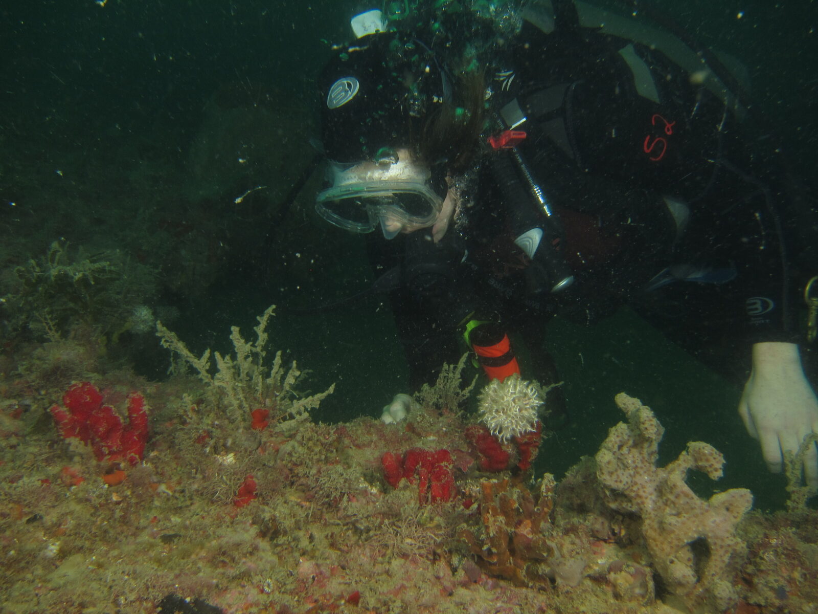
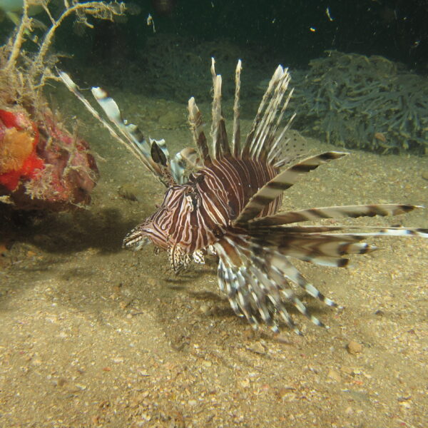
Fisheries management relies heavily on these types of population models. This is especially important to us in Florida, where we rely economically on commercial and recreational fishing and on ocean-based tourism. Monitoring of shark, turtle and recreational fish populations has slowed or stalled, though hopefully balanced by less human activity and reduced conservation threats. We are also missing out on monitoring invasive species, like lionfish, whose presence in new areas could affect the management of other animals.
So, what can we do?
While nobody can make up for data that has already been lost—after all, seasonal phenomena continue whether humans are there to witness it or not—we can make sure to make the most of it when it’s safe for us to do so. Check out local opportunities to volunteer with local groups, like bird counts led by the Audubon Society, turtle nesting counts locally in your area or local dive shops participating in the REEF Volunteer Fish Survey Project. Or think about writing to your representatives about science funding or student internships when we are past this crisis. A little extra manpower can go a long way towards getting things back on track for the future.
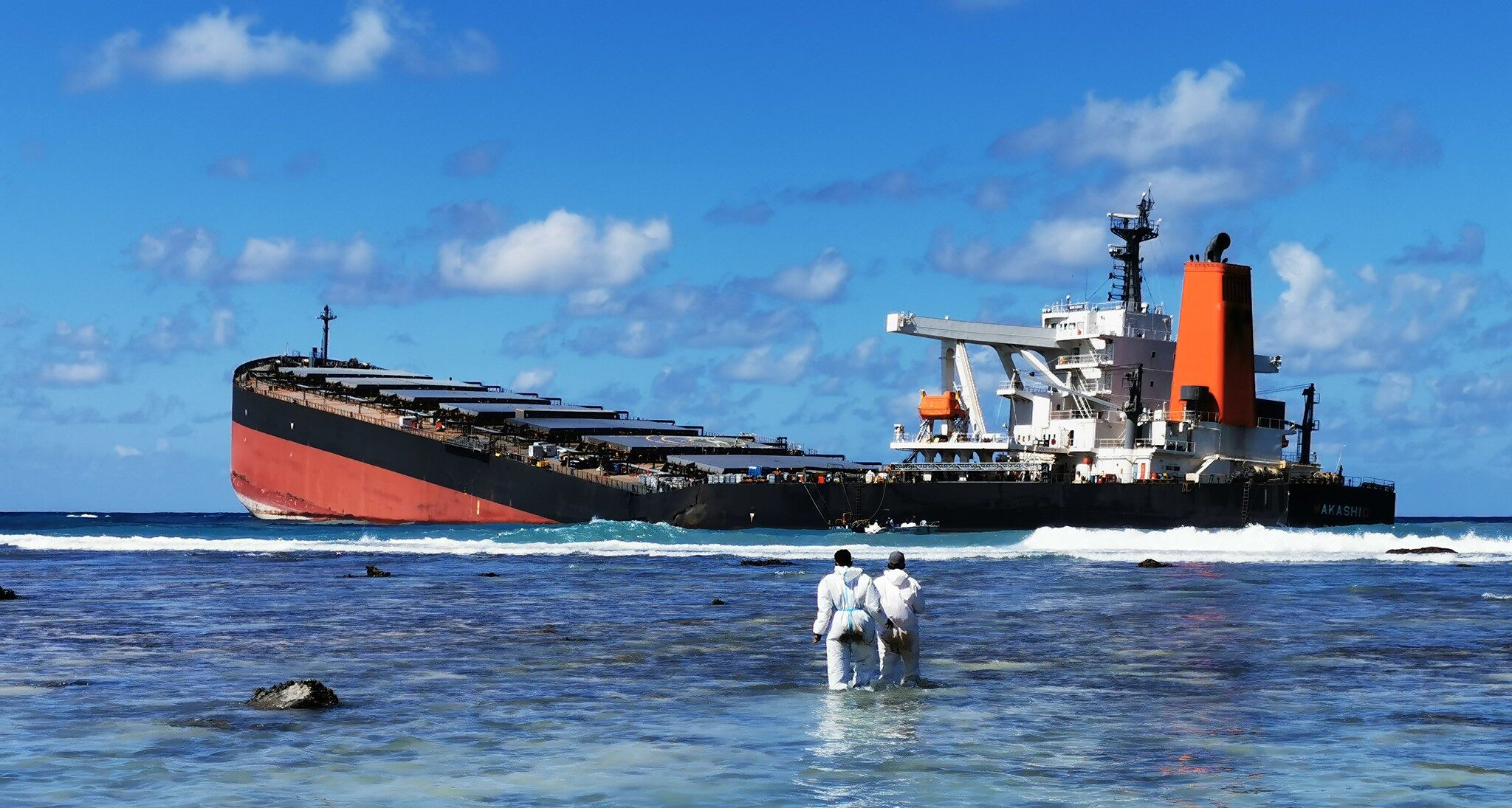
On July 25, the MV Wakashio was grounded on a coral reef off the coast of Mauritius. Since then, the ship has released 1,000 tons of fuel into the sea, where it has fouled the region’s biologically rich waters and coastlines.
The unfolding oil disaster in Mauritius is sadly and predictably all too familiar to me. Last month we commemorated the 10th anniversary of the capping of the BP-owned Macondo oil well in the Gulf of Mexico. 11 workers lost their lives when the Deepwater Horizon mobile drilling platform suffered a catastrophic blowout on April 20, 2010, discharging 210 million gallons of oil into the Gulf of Mexico for 87 days. In the days after the blowout, I was on the water surveying the damage, talking with frightened fishermen and preparing for the largest coastal and marine restoration effort ever undertaken.
My heart goes out to the Mauritians. I understand the shock, anger and anxiety they feel about the oil smothering their reefs and wetlands and taking a toll on their health, economy and way of life. I offer the following lessons learned from the BP oil disaster in the hopes they provide some useful perspective to those involved in the Mauritius response and eventual ecological restoration that must follow.
Avoid collateral damage from clean up methods
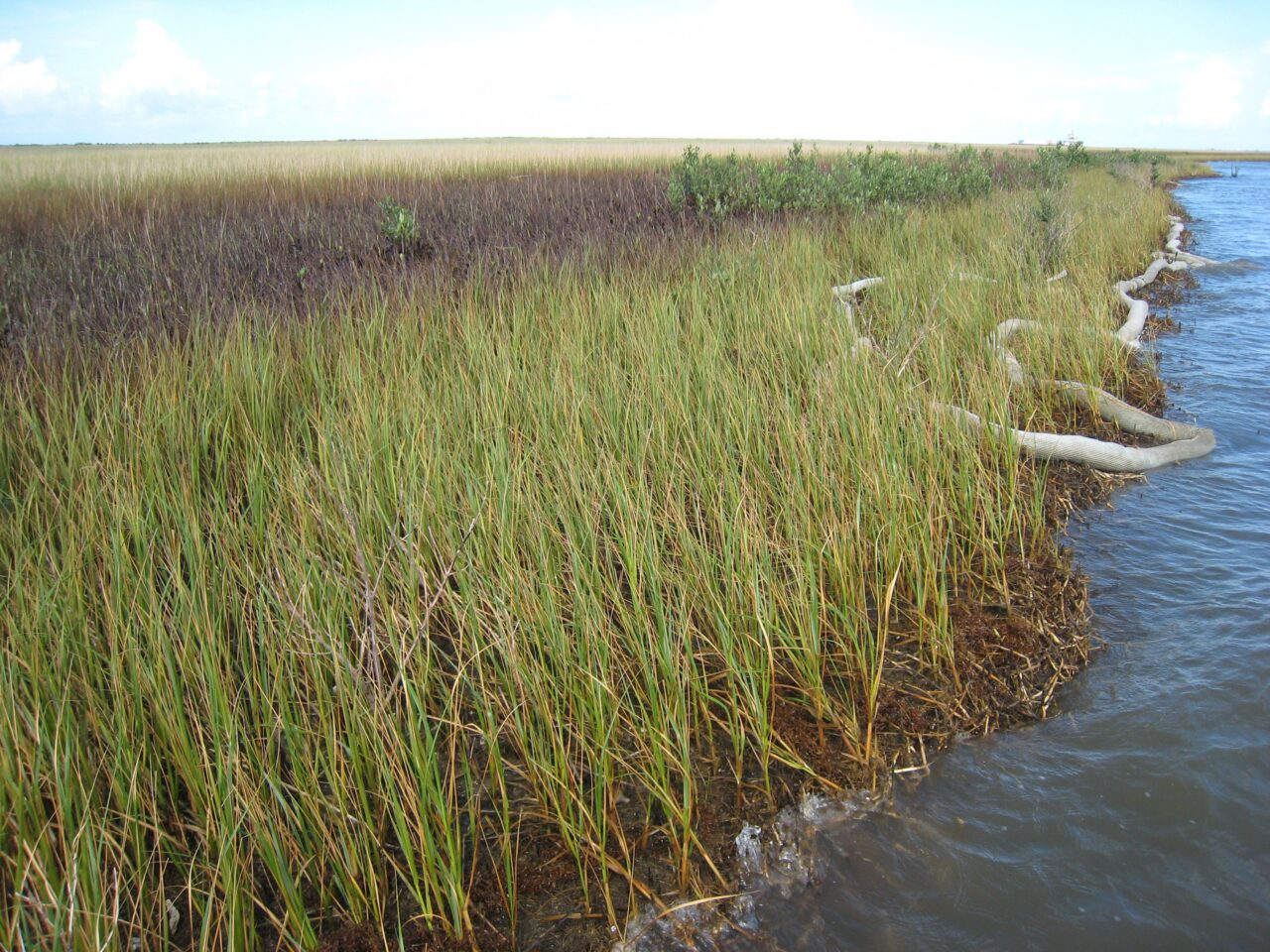
In the desperate rush to contain and clean up the oil, response techniques can inadvertently cause additional environmental harm if not deployed appropriately. Responders used 2,556 miles of boom to contain oil and protect sensitive shoreline habitats during the BP oil disaster. Yet, waves resulted in the stranding of hard boom and sorbents along hundreds of miles of shoreline that took months to remove. Mauritians are using their ingenuity to make natural booms made of hair, commendably minimizing the use of synthetic materials made of plastic. Regardless of the material used, close monitoring of booms along with changes in the weather is important to avoid unintended environmental consequences.
Never miss an update.
Sign up today:
...loading
Thanks for signing up for Ocean Conservancy emails.
Catalog the environmental and economic harm
While the current priority is rightfully on oil containment and removal, documenting the damage to the marine and coastal ecosystem is critical to holding the responsible party accountable and seeking damages. Wherever possible, it is important to establish a pre-oil disaster baseline of environmental conditions against which surveys of damaged habitat, species and ecosystem services can be measured. Comparing historical records of fish, bird, reptile and marine mammal presence and abundance with post-oil disaster surveys will help to isolate the oil spill impacts. The same is true for assessing lost ecosystem services such as tourism or fisheries landings so foundational to the island’s economy.
The party responsible for the Mauritius oil disaster should be legally and financially accountable under applicable international and domestic law and pay for the cost of cleanup and subsequent restoration efforts. Presenting a claim based on the cataloging of environmental harm and economic damages resulting from lost tourism and fishing revenue will help fund environmental restoration and compensate affected businesses. Making the environment and public whole from the oil disaster should be the top priority, and a claim prepared with the best available science will help ensure compensation is commensurate with impacts. Keeping the public informed through traditional and social media will keep the disaster in the news and the pressure on the responsible party to pay a claim.
While restoration cannot practically begin before clean up is complete, it is not too early to begin planning for it. Restoration should be ecologically integrated, adaptive and responsive to new insights about ecosystem harm and allow for early and continuous public involvement. The Deepwater Horizon oil spill restoration planning process was not perfect, but it identified goals and objectives tied to injuries at the resource and ecosystem level and gave the public opportunities to provide input.
The people of Mauritius are experiencing what too many communities, from Louisiana to Alaska to the Timor Sea have painfully faced. Ultimately, we must transition rapidly but responsibly from fossil fuels to renewable forms of energy that are not toxic to the environment and have a fraction of the carbon footprint. Our oceans and ocean-dependent communities deserve nothing less.
Ocean Conservancy has partnered with the City of Miami, Florida through the Shores Forward initiative to protect ocean and coastal habitats, species and communities. Partnering with a municipality as large and complex as Miami requires a strong and invested partner. Since launching eight months ago, Ocean Conservancy has been collaborating with Miami’s Office of Resilience and Sustainability (ORS) to advance important steps to protect local ocean resources.
Love our content?
Sign up to never miss an update!
...loading
Thanks for signing up for Ocean Conservancy emails.
What exactly is the Office of Resilience and Sustainability? This office is charged with working across departments to apply a resilience lens to the City of Miami’s operations, strategic planning and budgeting processes to strengthen its ability to address the systemic stresses and challenges it faces, as well as enhance its ability to prepare for and rebound from acute shocks. It seeks to build physical, social and economic resilience and sustainability in Miami through internal and external partnerships, and Ocean Conservancy found a valuable and committed ally in ORS’ Resilience Programs Manager, Melissa Hew.
Melissa has a strong passion for all things water. Having never lived more than five miles from the sea or bay, she couldn’t picture herself in a career field that did not allow her to work and “play” with water. After receiving her Master’s degree from Towson University with a concentration in Water Resource Management, she began working with the Maryland Department of the Environment in both the Science Services and Water Management Administrations. She joined the City of Miami’s Office of Resilience and Sustainability in June 2018, where today she focuses on developing and implementing strategies to protect and enhance the city’s natural resources. She also helps the City and its residents adapt to risks such as increased flood events, extreme heat, sea-level rise and storms.
“Miami’s history and future are inextricably tied to the river, bay and ocean. Clean water is non-negotiable; Miami depends on a thriving Biscayne Bay and river ecosystem for recreation, tourism and economy. Harmful algal blooms and fish kills are just two visible warning signs that the health of Biscayne Bay and its water quality are at dire risk.”
Melissa Hew
Resilience Programs Manager, City of Miami
At ORS, Melissa has collaborated with Ocean Conservancy to support a fertilizer ordinance in Miami. The ordinance passed unanimously and was sponsored by three commissioners (District Two Commissioner Ken Russell, District Three Commissioner Joe Carollo and District Four Commissioner Manolo Reyes) as well as the City’s Mayor, Francis Suarez). Strong support for the fertilizer ordinance showcases Miami’s commitment to protecting Biscayne Bay and strengthens the foundation of the Shores Forward partnership. The Florida Friendly Fertilizer ordinance is just one step of many on the road to improving the health of Biscayne Bay and safeguarding the future of the waterways that help to make Miami a worldwide coastal icon.
Today, Ocean Conservancy and City of Miami’s ORS team are working to complete a first for a major United States city: a plastics pollution survey in its waterways. University of Georgia Professor in Environmental Engineering, Jenna Jambeck, is partnering with Ocean Conservancy to complete a Circularity Assessment Protocol (CAP) that will observe, catalog and analyze aquatic macroplastic pollution in Miami. With the information from the CAP, Melissa and her colleagues at ORS will have science-backed results to help advance more responsible water quality measures at the city level that can help increase public health, marine species and habitats, and leverage an underutilized resource in Miami: its rivers and expansive bay. Follow along with the City of Miami’s official Twitter to be the first to hear about their latest updates and ways to help support their resilience and sustainability work.
What’s at the bottom of the deep dark abyss that is our ocean? This centuries-old mystery has been ingrained in cultures around the world and fuels our imaginations to this day. Mermaids, giant sea monsters, ancient civilizations, ghosts, aliens—you name it, there’s some mythical, “Buzzfeed Unsolved-esque” lore about it that starts at the bottom of the sea.
Love our content?
Sign up to never miss an update!
...loading
Thanks for signing up for Ocean Conservancy emails.
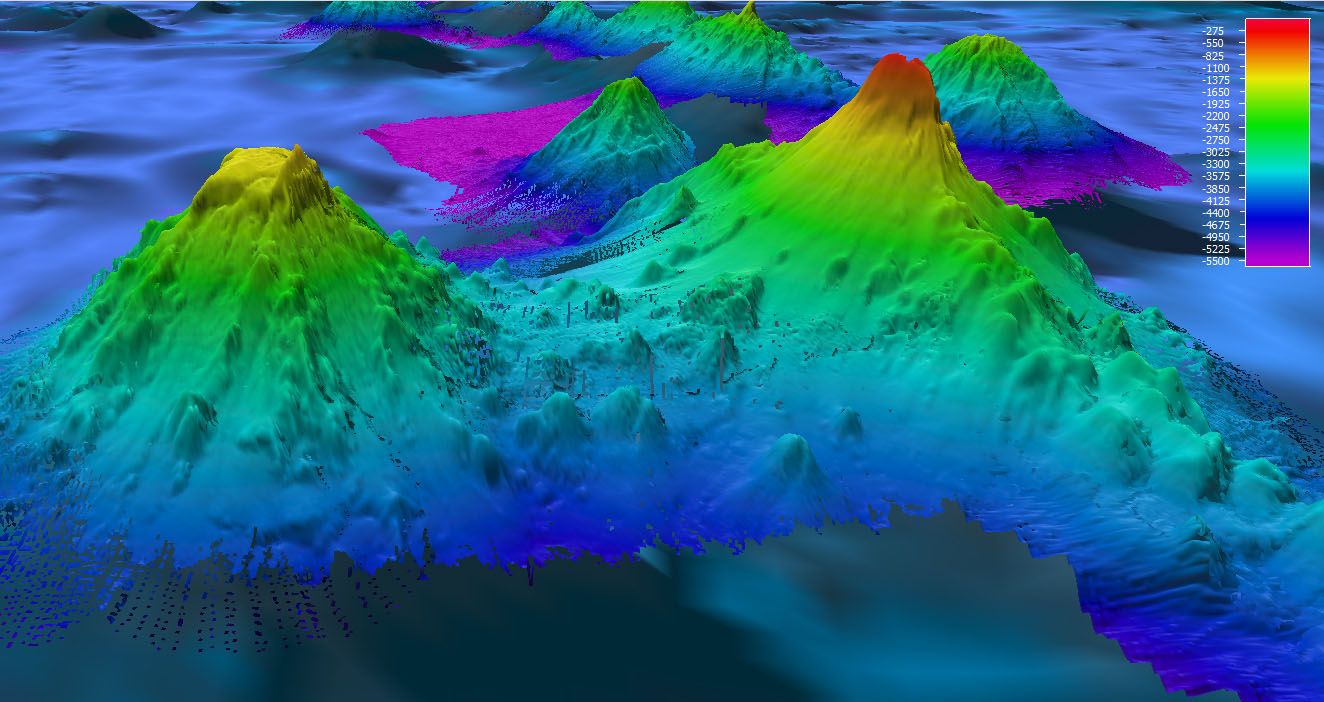
So, what’s really down there? Well … the truth is no one knows! I’m not saying there’s a chance you’ll discover the Little Mermaid, Davey Jones’ Locker or the Kraken; any scientist would explain to you that there’s a boatload of evidence (or no evidence at all) that suggests any of those things are real. But until 2017, only 6% of the ocean bottom had been surveyed! We know more about the surface of the Moon and Mars than the bottom of the ocean!
The good news is the Nippon Foundation and the General Bathymetric Chart of the Oceans (GEBCO) have since been working to map the entire ocean seafloor as aligned with the United Nation’s Sustainable Development Goal #14: Conserve and sustainably use the oceans, seas, and marine resources. BBC recently did a story on their project, Seabed 2030. As their name suggests, their goal is to collect all available data to produce a complete map of the global seabed by 2030. They also want to make all of that information publically available. To date, they’ve completed about a fifth of their mission, collecting approximately 5.6 million square miles of new seabed data. For reference, the United States is about 3.8 million square miles!
As cool as it would be to discover some sort of mythical creature or sunken gold, that’s not why Seabed 2030 got started. The treasure they’re after is data. This hidden knowledge will enable us to advance our understanding of ocean circulation, tides, tsunamis, fishing resources, sediment transport, environmental changes and underwater geological hazards. This will help us more effectively plan for climate change, sustainably manage fisheries, create safer shipping routes and responsibly site underwater cables for developing projects like offshore wind farms. These industries and other businesses that add to the blue economy play a significant role in the global economy at large. In the United States alone, the blue economy annually brings in more than $300 billion—$129 billion in wages and 3 million jobs. That’s like providing jobs for the combined populations of Wyoming, Vermont, Alaska and North Dakota with more than an extra 300,000 jobs to spare!
Finding all of this data from around the world will help the entire world, but it’s not a simple process of just hopping on a boat and scanning the ocean. It’s just too vast to do alone. A global project like this needs a global effort. Much of the data added to GEBCO over the last few years didn’t require them to spend a single additional minute at sea. As it turns out, the data had already been collected by entities like foreign governments, academic institutions and private companies and kept siloed in their own databases until Seabed 2030 worked with them to share the data. There’s likely much more data out there that’s hidden not on the seafloor, but in the digital cloud.
The United States is also embarking on this collaborative approach when it comes to ocean exploration and mapping. Last month, NOAA and federal partners released a National Strategy for Mapping, Exploring and Characterizing the United States Exclusive Economic Zone (EEZ) in response to the administration’s Presidential Memorandum. Similar to Seabed 2030, the goal is to leverage existing and emerging technologies with private industries, academia, non-governmental organizations and other key stakeholder groups to create a publically available map of deep water by 2030 and nearshore waters by 2040.
Space may be the final frontier but our ocean is the most pressing.
During this time of great isolation and physical distancing, it’s comforting to know that people are still able to find a way to safely communicate and collaborate in service of knowledge that will help the planet. I’m excited to see what we find deep in the ocean and how it’s going to change the way we see each other and the world.
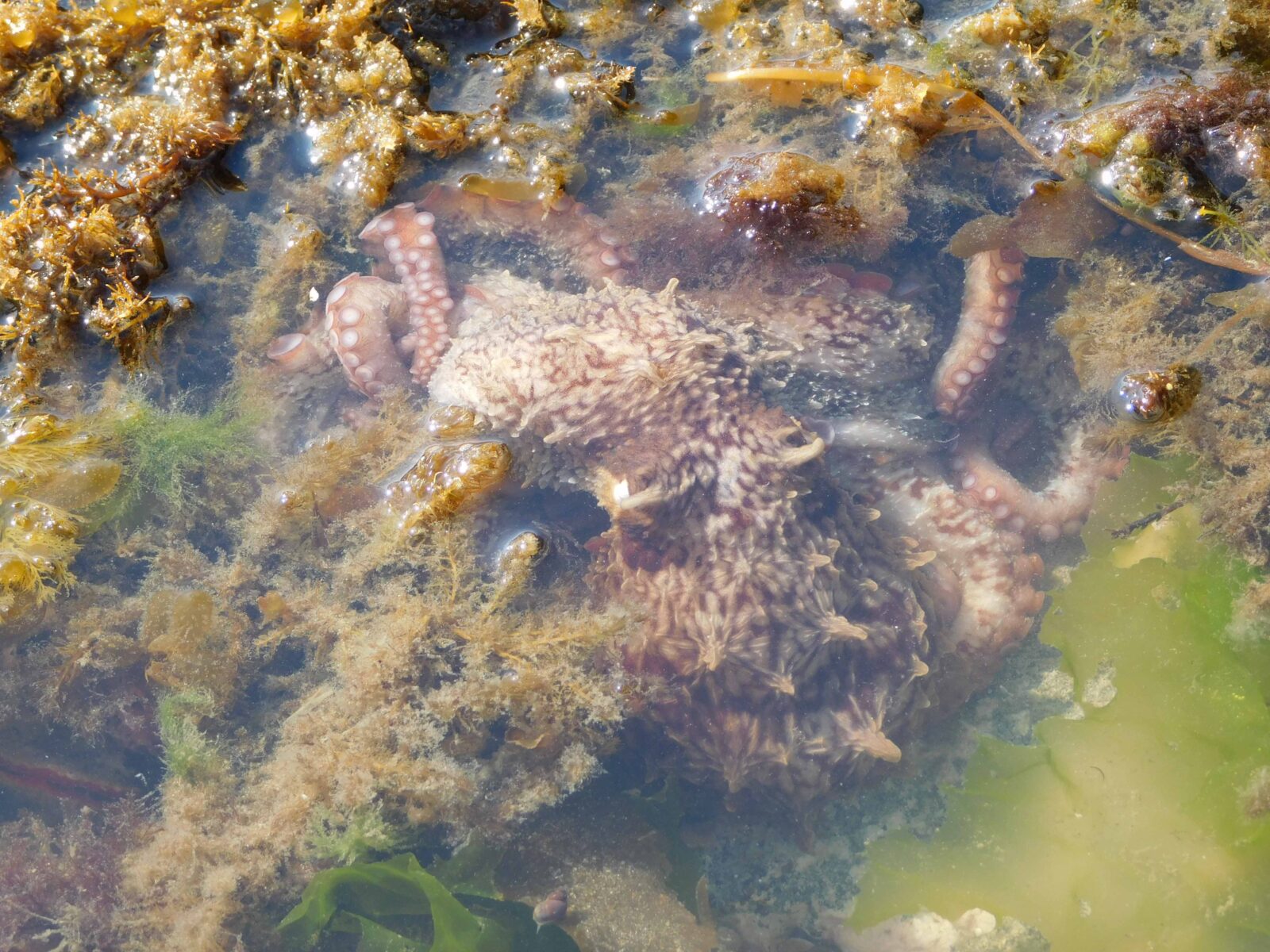
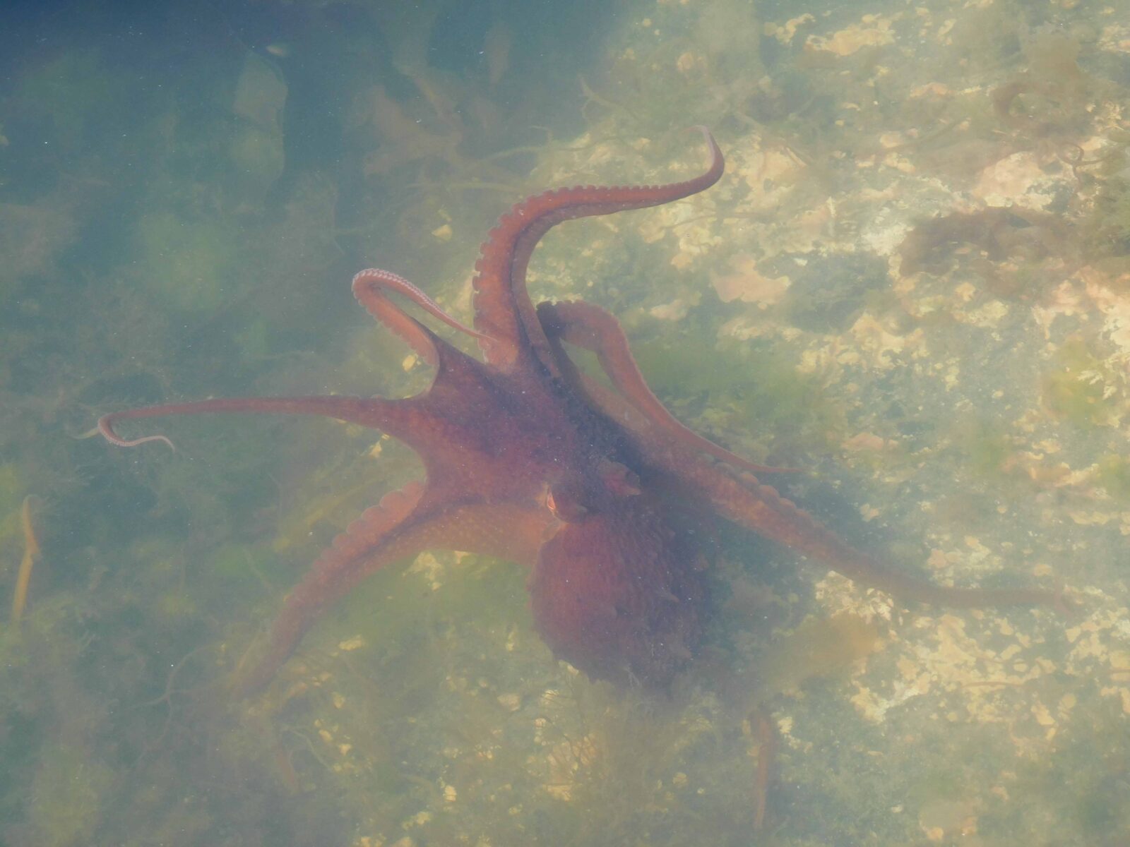
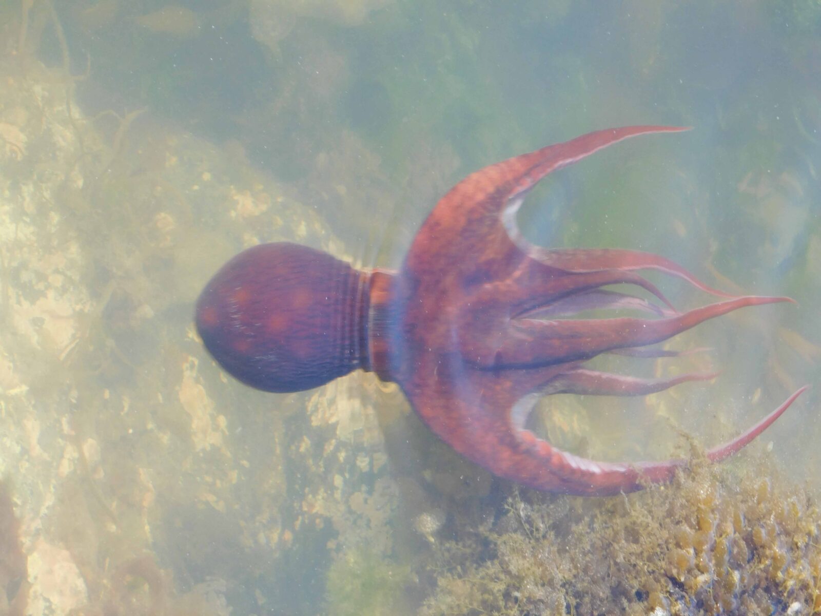
What lives in the sea and has eight arms covered with suckers? We all know the answer: an octopus!
What lives in the sea and can change both color and texture? Also an octopus!
What lives in the sea and can walk on the bottom and shoot through the water? Still an octopus!
Love our content?
Sign up to never miss an update!
...loading
Thanks for signing up for Ocean Conservancy emails.
We may know many things about octopuses, but seeing one in action is still extraordinary. We recently spent five nights camping and kayaking in Kachemak Bay, Alaska. Competition was stiff for the highlights of the trip. Among the leading candidates were a pod of orcas swimming past our camp one evening, fresh pink salmon cooked over the fire and even—in a very different way—a midnight tsunami warning that saw us hiking up the mountainside to safety until the all-clear message came through.
Still, we couldn’t stop talking about watching a young Pacific octopus in a tidepool one morning. It walked through the shallow water:
No wonder we return time and again to the same waters, delighting in the variety of joys a healthy ocean offers up, even in a few feet of a tidepool, when we can take the time to explore!